Research Experience (Academic)
Undergrad Thesis (2018)
"An Experimental Study on Wave Interaction with Vertical Slotted Breakwater"
Presented in the 7th International Conference on Water and Flood Management, 2019, Dhaka, Bangladesh

- Breakwaters are widely used for ensuring safe harbor. Traditional solid breakwater causes sedimentation on the landside, thus degrade the navigational draft of harbor. In this study hydraulic performance of perforated breakwater was examined.
- Reduction in wave energy was determined experimentally for 2 types of setup: single wall and double wall vertical slotted breakwater, with different wave periods and relative submergence of breakwater.
- Based on the experiment, the double wall model with 1.2 relative submergence performed best with a 0.902 energy loss coefficient and 57.89% wave height reduction.
Master's Thesis (2023-2025)
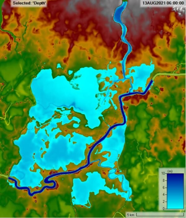
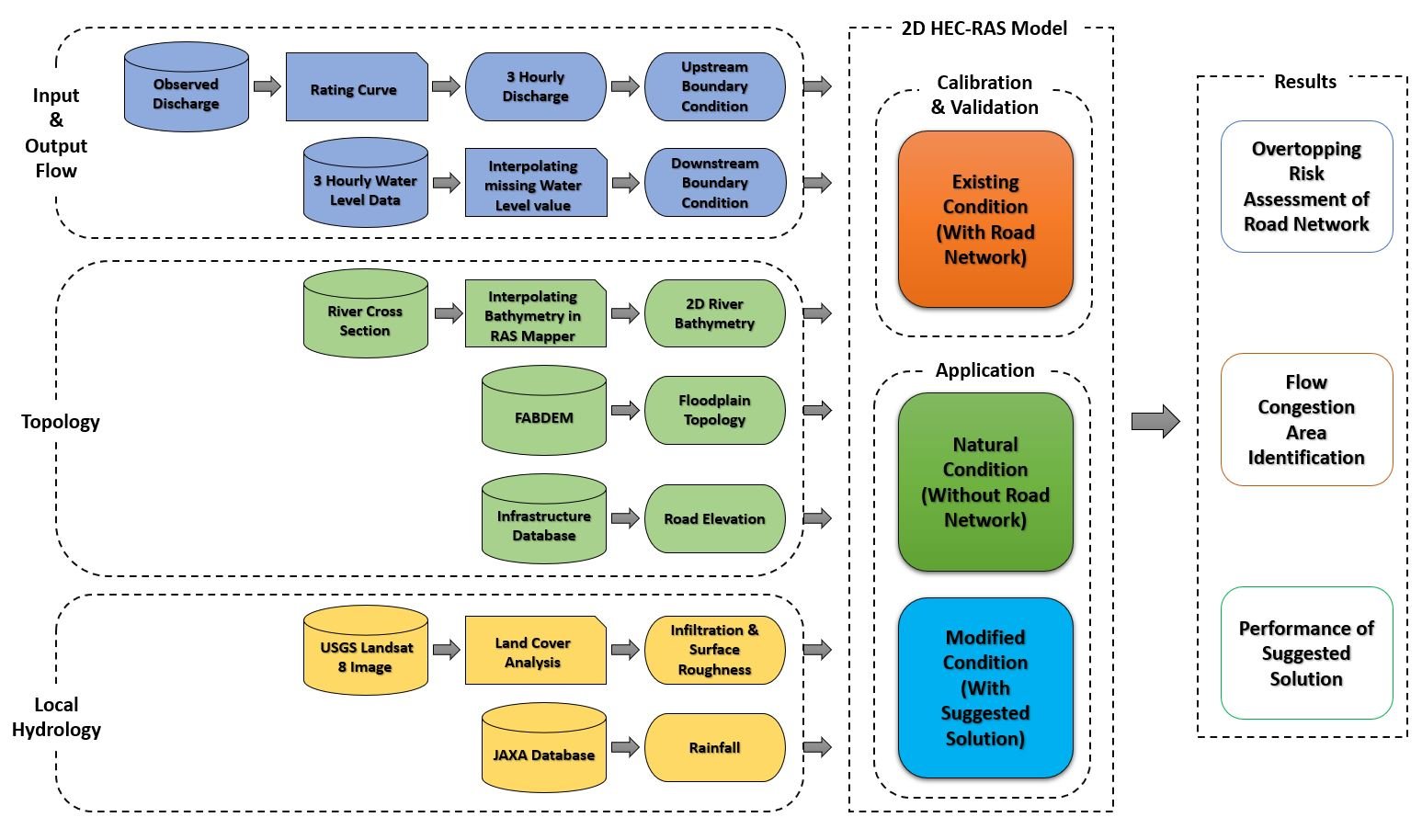
"Effect of Road Network on the Flood Intensity of Haor Basin in Bangladesh and possible solution"


- The north-eastern haor basin of Bangladesh is exposed to flash floods during pre-monsoon and monsoon seasons almost every year. In the monsoon period, the flood water flows over the floodplain, but the construction of more and more high-elevation roads here hinders the natural hydraulic connectivity.
- In this study, for a selected river system of the Haor basin, the flood condition will be assessed for existing and natural (without any road and embankment in floodplain) conditions using the HEC RAS 2D hydrodynamic model.
- It has been found that, these structures can prolong the flood duration up to 50% in the upstream areas, by obstructing natural overland flow pattern.
Research Experience (Professional)
- Meteor-Hydrological data analysis: Rainfall Frequency Analysis, Design Discharge determination using Intensity Duration Frequency (IDF) and SCS curve number method.
- Data preparation for Susceptibility mapping.
- Methodology development and questionnaire formulation for Climate Change Risk Assessment and Participatory Scenario Development.
- Climate Vulnerability analysis.
- Field visit: Focal Group Discussion (FGD) and Key Informant Interview.
- Assessment of Irrigation Water Requirement using CROPWAT 8.0
- Water availability assessment using SOBEK.
- Dependable flow and water source sustainability analysis.
- Detailed hydrodynamic analysis of Irrigation network (Ashuganj) using SOBEK 1D.
- Trend analysis of historical rainfall and temperature data.
- Bias correction of downscaled climate data.
- Generating design rainfall event using Alternating Block Method.
- Urban catchment delineation for assessing adequacy of existing and proposed drainage structures using EPA SWMM.
- Simulating urban storm drainage network using SWMM and criticality assessment of existing network.
- Storm Drainage Modeling using PC SWMM
- Detailed Cost Estimation
- Thematic mapping of geospatial features of Jamuna, Sangu, and Matamuhuri Rivers.
- Predicting river bank shifting of the rivers mentioned above using the Digital Shoreline Analysis System (DSAS) extension of ArcGIS.
- Risk assessment for road, settlement, and other infrastructure at the downstream reach of Sangu and Matamuhuri Rivers.
My Tools
